This article covers the following topics:
What are map views?
A map view displays records from your database on a map in your Live App. Knack uses maps to display geocode address field values.
You have the option to use Google as your map provider by adding your API key. This setting can be found on the Settings > App Settings > Map Provider page.
Note: As of 2024-01-29, any Knack apps that are using Google Maps as the map provider will require a Map ID to be entered in the App Settings > Map Provider section of the Builder. See Google's documentation on creating a Map ID here.
General Notes About Map Views:
-
The map view is currently only available on the Pro plan and above.
-
Maps can only display tables that have an address field. This address field will be geolocated and will determine which records the map will display.
-
When using the latitude/longitude coordinates option for an address field, that location will display as the nearest street address on a map view, rather than the exact coordinates.
-
Map views will automatically generate direction links that, when clicked, will open a new window for Google Maps where the user can get directions.
-
Address fields used in map views where the address autocomplete functionality is enabled will allow this autocomplete functionality in the search input.
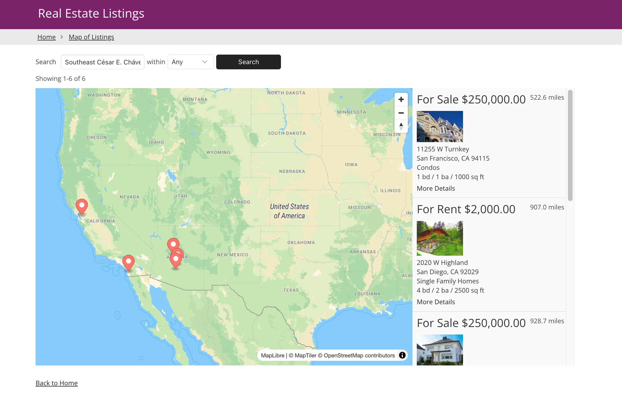
What do maps look like in the Live App?
Maps display multiple records from one of the tables in your database:
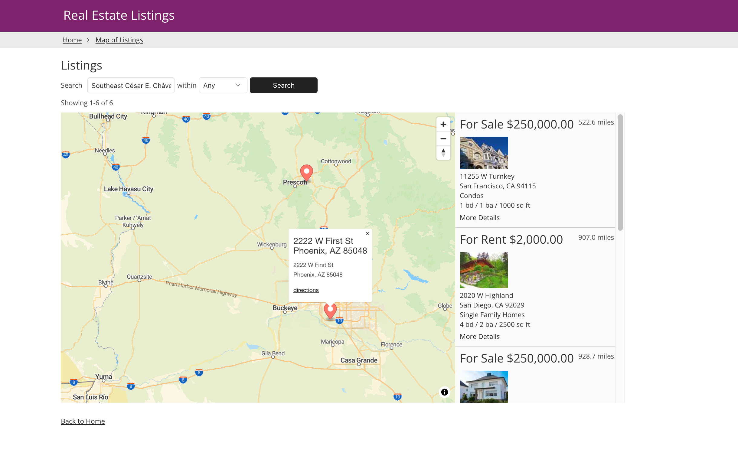
On the search results display, a “reset” link will appear. Clicking this will reset all search criteria to easily search again with new criteria.
Instead of using our default map feature, you can also choose to use Google Maps by entering your API key. See the section above for more details on this.
Managing Maps
To learn how to add, edit, and delete map views from your app, see our article About Views.
Maps Settings
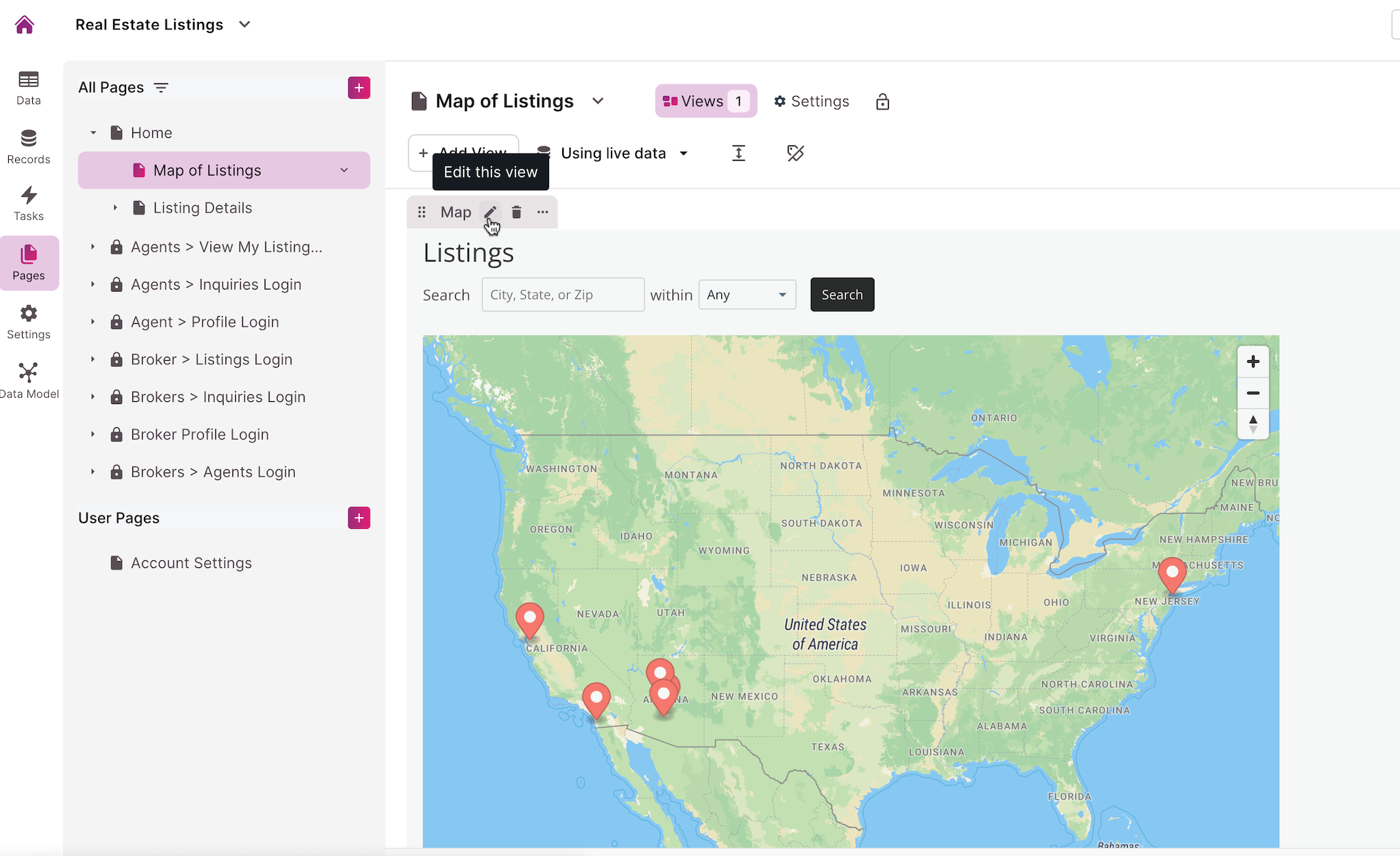
To access the settings of a map view, hover your mouse over the view and click on the pencil icon that appears at the top left of the view.
Source
The Source section is used to control the records the map will display:
/About%20Map%20Views/maps3.png?hsLang=en)
In this section, the following options are available:
-
Filters: The map will display all the table's records by default. Use the Data section to add rules to limit which records will be displayed.
-
Limit: Show all the available records or limit the shown records to a specific number.
Note: Currently, map views can only show 1,000 records at a time.
Tip: To learn more on working with the view's source, see our article here.
Map Options and Settings
The Map Settings section is used to control how the map works with your table to display addresses:
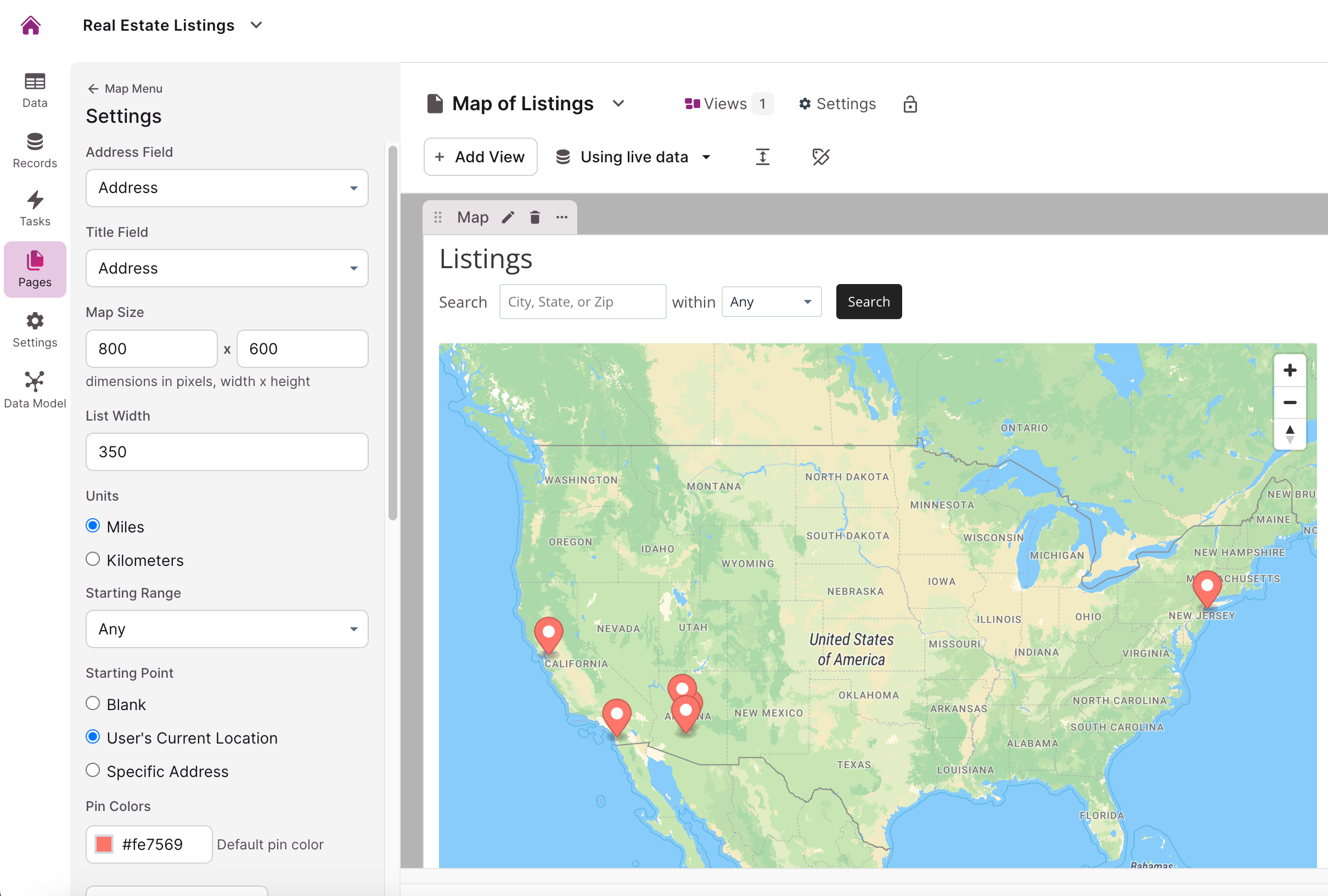
Here is the list of customization settings available from the map's options and settings section:
-
Address Field: Select a field that the map will use as the address to place each location on the map. This field must be the Address type.
-
Note: New maps will use the first address field to display records in the map as well as the first short text field as a label when displaying address details.
-
-
Title Field: Select a field the map will use to display an address point. Choose a title, name, or other field that can easily identify the whole record.
-
Map Size: the dimensions of the map in pixels. Use these to control how big you want the map to be.
-
List Width: This is for the width of the list that displays to the right of the map and contains the record details (see below). If the map and list width combined won't fit on the screen, then the list will bump below the map and be the same width as the map.
-
Units: Select which unit of measuring distance will be used on the map: miles or kilometers.
-
Starting Range: This is for the distance of the range to search by based on the selected unit (above). A record address must be within this distance of the searched address.
-
Starting Point: Blank, Specific Address, or User's Current Location.
-
If Blank, then no records will show until the user initiates a search.
-
If an address is provided, then the map will start with records closest to that address.
-
When using the User's Current Location, the browser will ask the user's permission to locate them and use that location.
-
-
Pin Colors: Add custom rules to display different pin colors based on criteria you define.
-
Pagination: Pagination determines how many records will show at one time. If the total number of records exceeds the pagination number, then links will be added to the table to navigate all the pages. Options here include:
-
Set how many records to show at a time
-
Let the user set how many records to view per page
-
Show pagination controls at the bottom of the view
-
-
Filters: Filters give the user tools to further refine which records the map will show. You can add filters as options for the user to add or as a menu.
-
User Filters: Enabling user filters presents options for a user to add any filters they'd like to the map. This will then display an "add filter" link above the map. The map will update as soon as a filter is added. Multiple filters can be added as needed. You can determine if the fields available to filter are limited to the map details or all the table's fields. You can add preset filters that will initially filter the records.
-
Filter Menu: Enabling a filter menu will present links above the map the user can click that will filter the records based on the rules you create.
-
Location Details
The Add Map Details (Location Details) section controls the list that displays to the right of the map with additional details about each record:
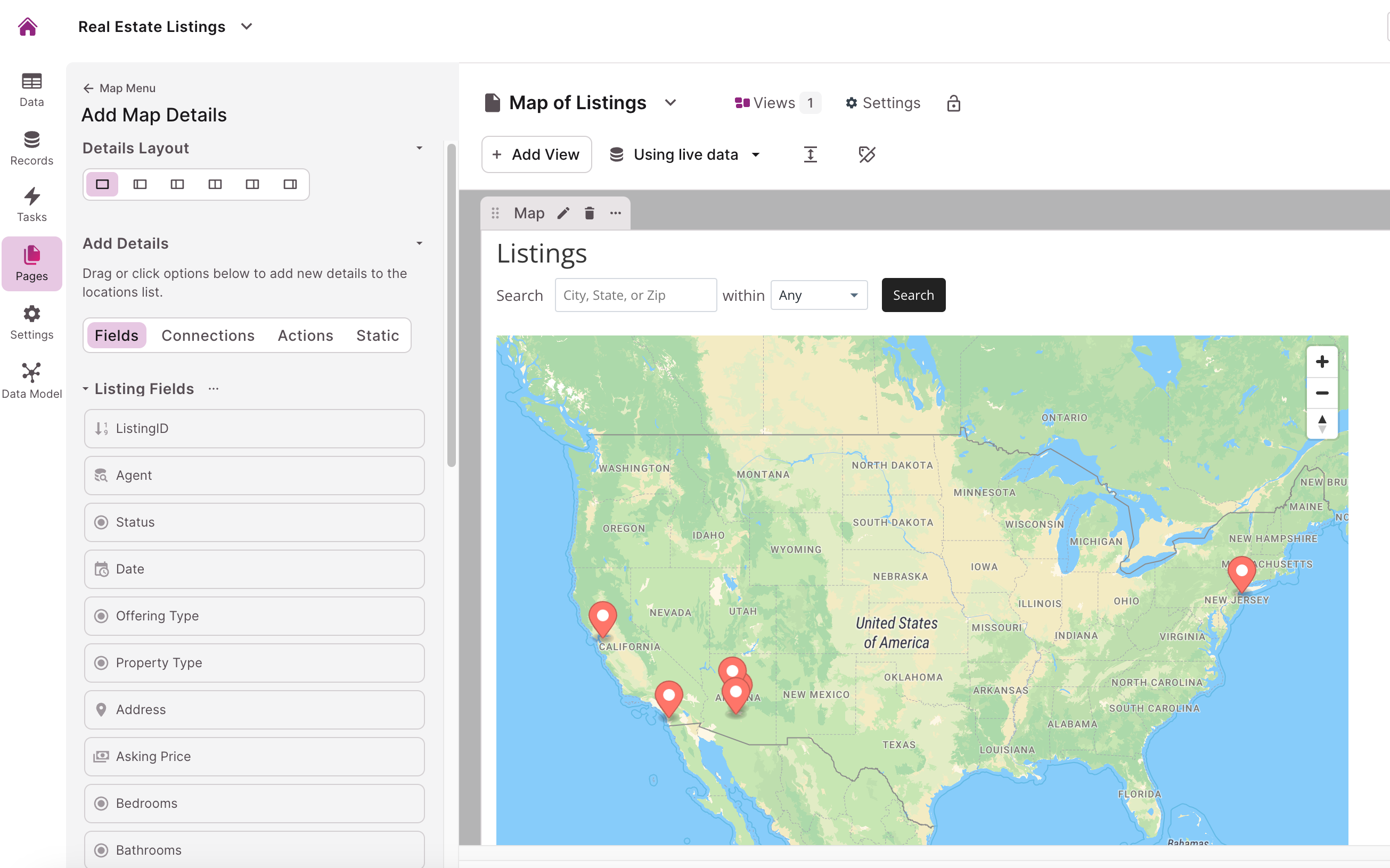
This list follows the same model as a details view.
Tip: To learn more about managing details, see our article here for more information on details views.
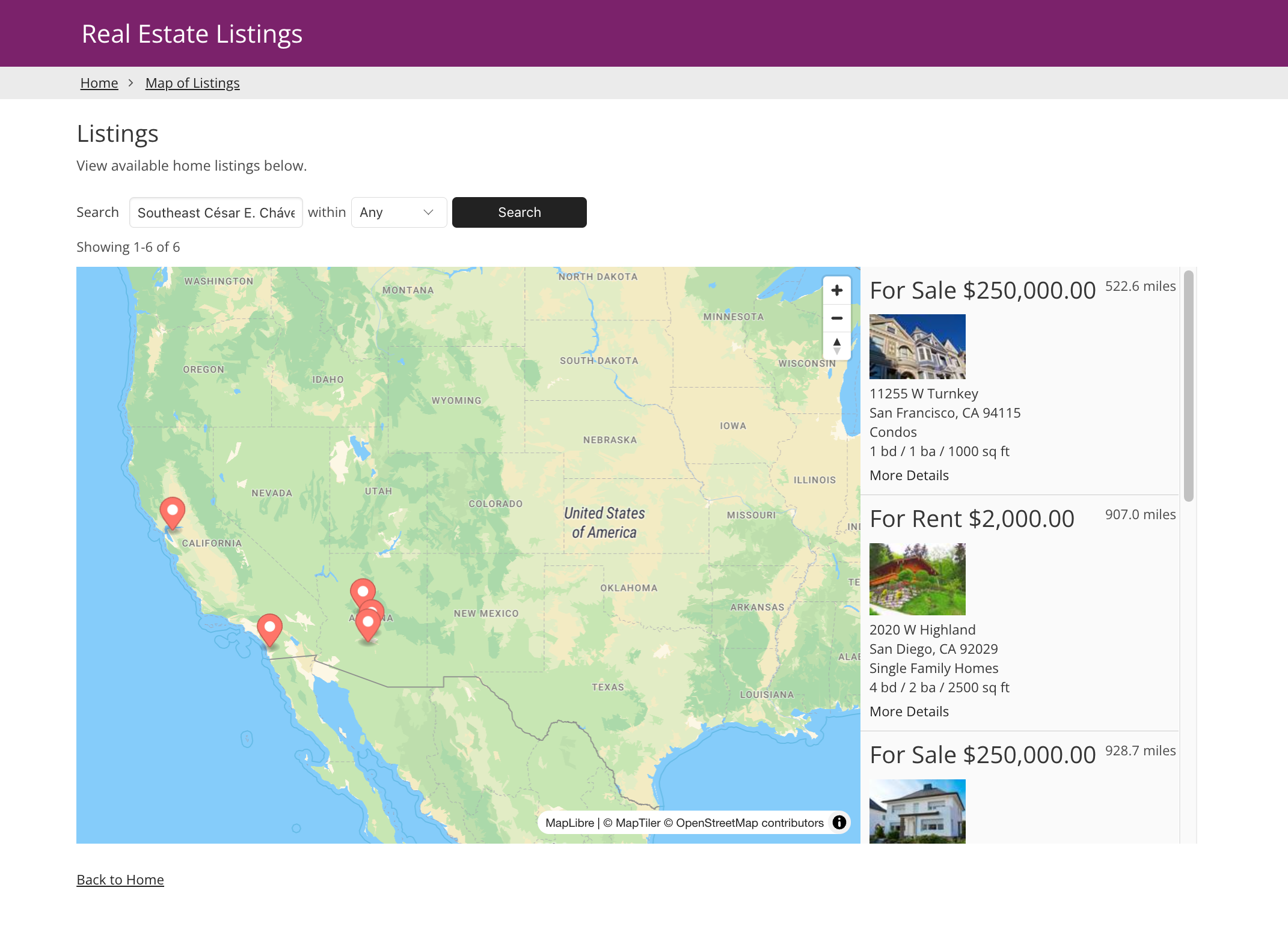
Title and Description
In the Map Settings section of the view editor, you can customize the title and description of your map or leave them blank.
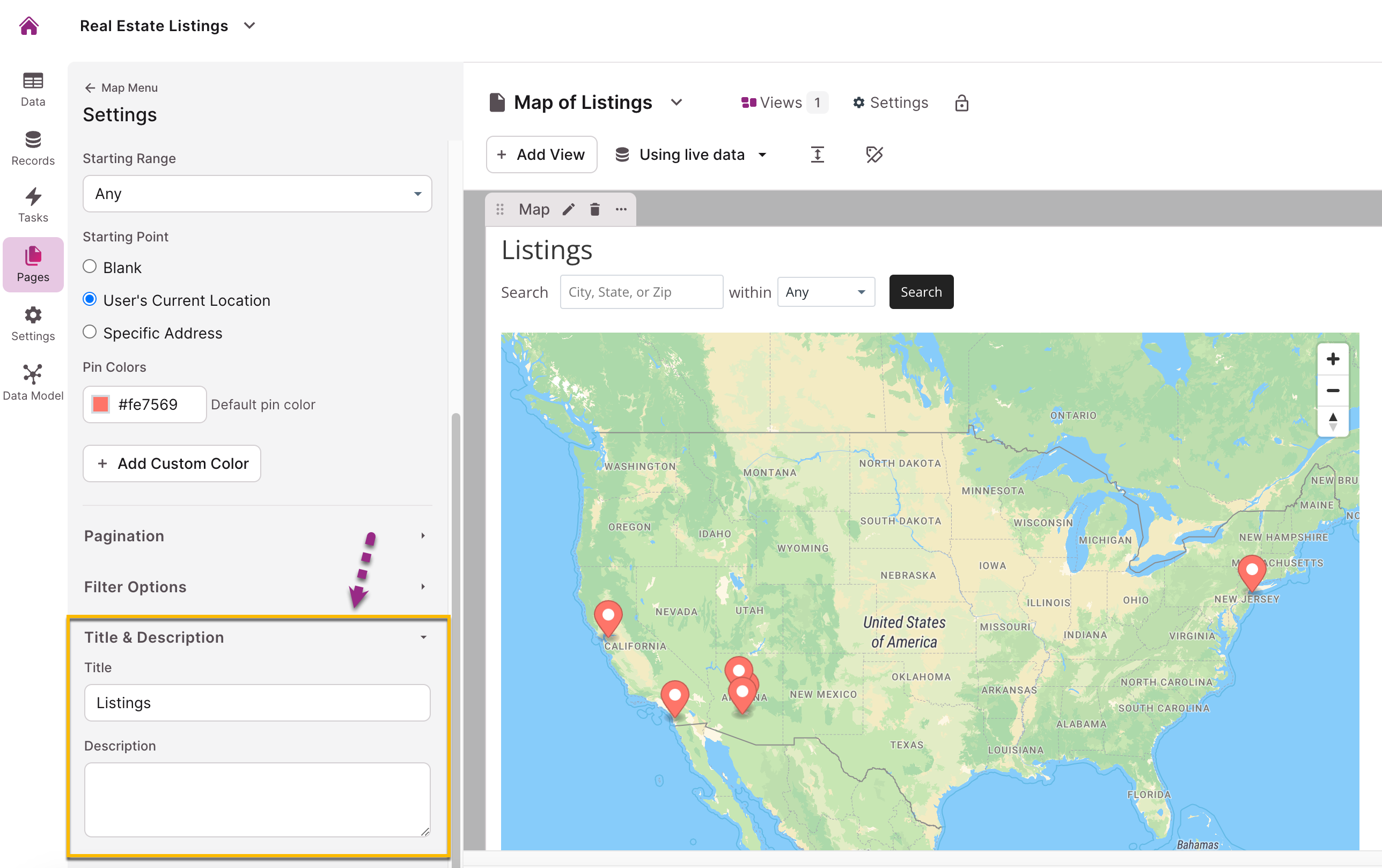
Here is what a map view looks like with no title or description:
Here is what a map view with a title and description looks like:
Searching with a Map
Maps currently support the below searches:
-
Street address + city
-
Street address + state
-
Street address + city + state
-
City + state
-
State (resolves to the state capital)
Unsupported searches include:
-
Street address only
-
City only
-
ZIP code only
-
County only
How to Guides
There are several How-To Guides that involve using Map views and our location features for capturing and displaying records:
Notes
-
Currently, for pagination on map views, you can display a maximum of 100 records at a time.
-
For the source settings, map views can show a maximum of 1,000 records in total.
-
Currently, there is no option to set maps to satellite view or terrain view.
- In the Builder and Live App, we are investigating an issue where address fields using address auto-complete and with the format of "International (with country)", are not populating the province/region field correctly for some addresses located in New Zealand, Australia, Belgium, Taiwan, and Spain.
- Address fields with lat/long format and geo-coding enabled may contain coordinates without a land address (e.g., ocean locations). These values are stored but not displayed in the UI. "Is blank" filter includes these fields. To view stored lat/long values, disable geo-coding.